Jean Jullien’s symbol created in the aftermath of the Paris attacks.
My map of Iceland
I have arrived from flying all day. I met some nice folks along the way. I am quite tired but can’t sleep. I have just unpacked my wool stuff from Iceland and am resisting importing and beginning to sort through my photos. That, and the 4K video from snorkeling at Silfra, will take some time.
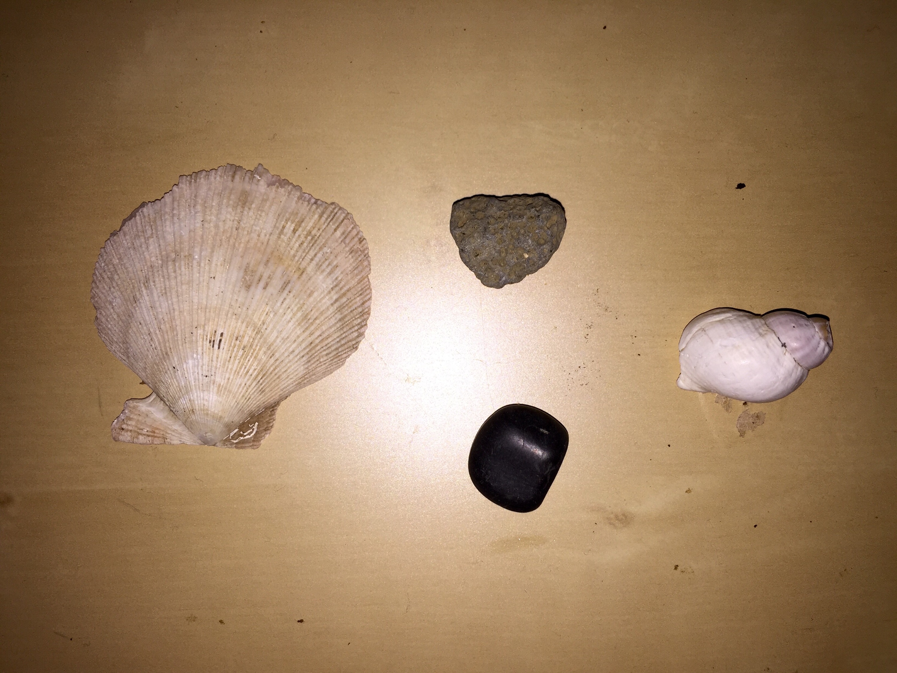
Here is my map of Iceland as seen through artifacts that I collected. From the black smoothed rock from the Black Sands beach to porus volcanic stone from the thermal area around Myvatn. The clam shell is from the rocky shores of the south western peninsula and the sea shell is from the east fjords
Map with most photographed locations in Iceland
An interesting crowd sourced map showing the most photographed spots in Iceland here. I’ve stopped at a few of these places!
A hot tub with a view
I left Grundafjordur early this morning to avoid the storm pounding the peninsula. I slowly made my way south to Borganes and am here overnight and then on to Silfra for a dive tomorrow. I will spend one final night in Reykjavik and then back to Ottawa.
Here are a few from today including my hot tub in Borganes where I’m sitting enjoying a glass of wine and watching the sun set.


Snaefellsnes part two
Here are some photos from yesterday. I climbed another volcano and hiked the sea shore. I stayed ahead of the major precipitation but it was a grey day. I started with Kirkjufelll and ended with the Black Church at Búðir. FYI the church is black because it is covered in pitch for the weather, much like a ship.


It was a dark and stormy night
Last night was the fiercest weather that I have seen in Iceland. The rain was strong and steady but the wind raged across the countryside or so I observed from the comfort of my room overlooking Kirkjufelll. With no possibility of seeing the lights I decided the begin to organize myself for my return and to read some lengthy articles. One of which that I found most interesting was this story about a 19 year old mapping the fluid lines of jihadis in North Africa and south west Asia. It’s a fascinating story of the convergence of intellectual curiosity and technology.
Snaefellsnes
I arrived at the Snaefellsnes peninsula yesterday, the final leg of my tour. The sky was clear yesterday and that meant some great photos but since the sun is so low in the sky all day it was quite challenging to drive.
I didn’t complain about clear skies last night since the northern lights were out in their full glory! I saw several shooting stars and while a little cool outside, I was quite warm in my new Icelandic wool sweater.
Awesome photography last night! I can’t wait to edit my photos!!


Skyr and little spoons
I have been eating a lot of Skyr. Iceland’s yoghurt. Damn it’s good.
What is quite interesting is the fact that it comes with a fold out spoon that packs inside the lid. I wonder why we don’t have that in Canada or perhaps we do and I’ve never noticed it.


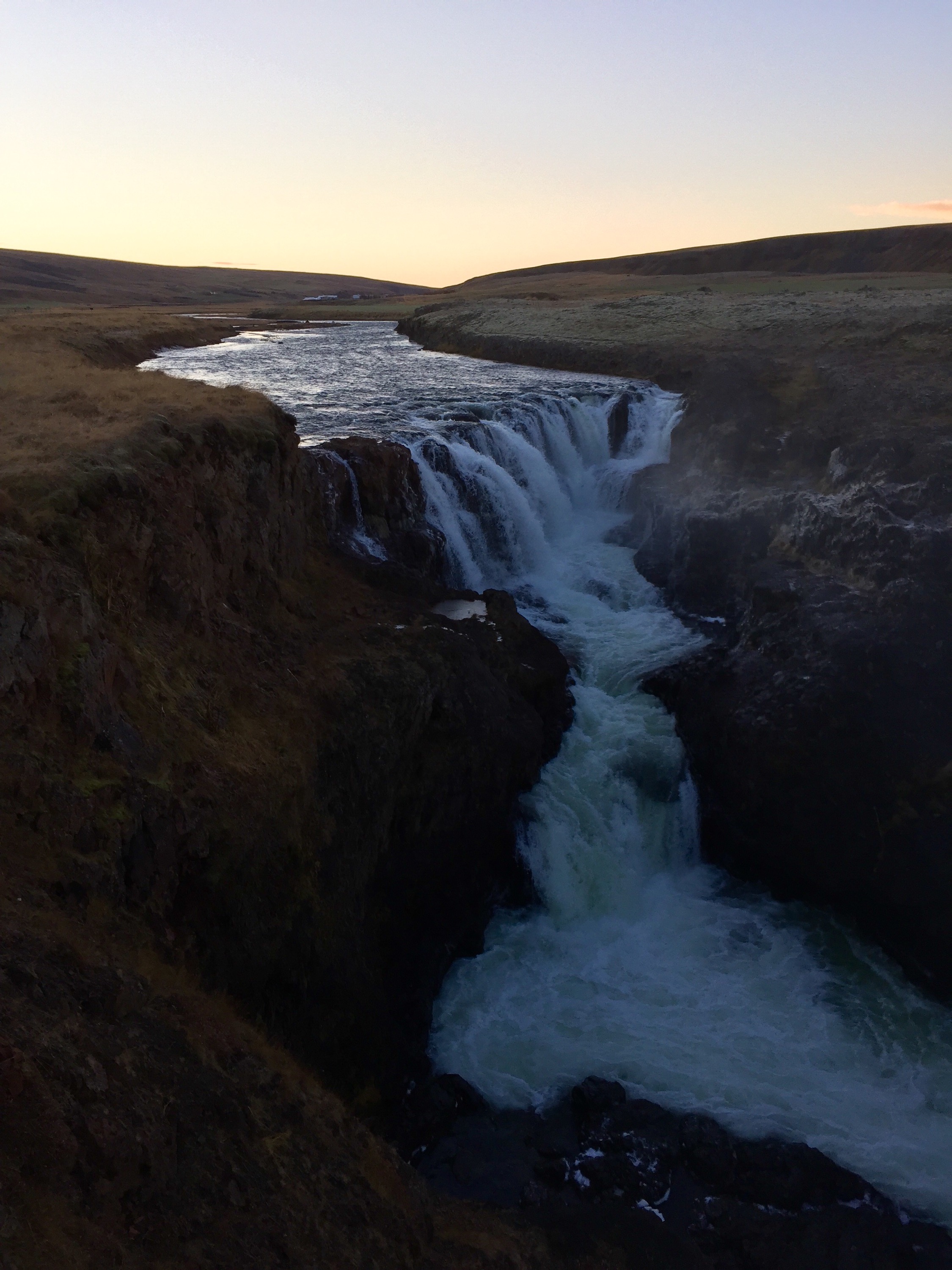
Winter, hot tubes, and Europe’s most powerful waterfall
Wow! What a day!
I left Egilstader right after breakfast this morning ready for the long drive to the North. The landscape changed rapidly and snow covered the ground. The sun was out and as I went inland, the chill of the humid sea air was no more.
The mountains were phenomenal! I made good time once I crossed the mountain range that was covered with snow. As I reached the flatter land I opened my car up and blasted an old Bruce Sprinsteen album.

Since I made such good time I diverted to Dettifoss first rather than Lake Myvatn right away. Since it was a nice day I wanted to take advantage! The route to Dettifoss was an unpaved road that was closed, meaning it wasn’t plowed. I blazed the trail and after an hour, and the car in front of me giving up, I hit snow that threatened to swallow the truck. It was wet and fresh and covering the massive pot holes underneath. I didn’t think I would make it but, as usual for Iceland, just when you don’t think you’ll make it, there it is!
Dettifoss is massive and incredibly powerful. I could hear it’s roar from where I parked my car. At 45 meters (you’re welcome MVH) it isn’t the tallest but boy is it powerful!
Here I am at Dettifoss:

Wait… That’s from the movie Prometheus. 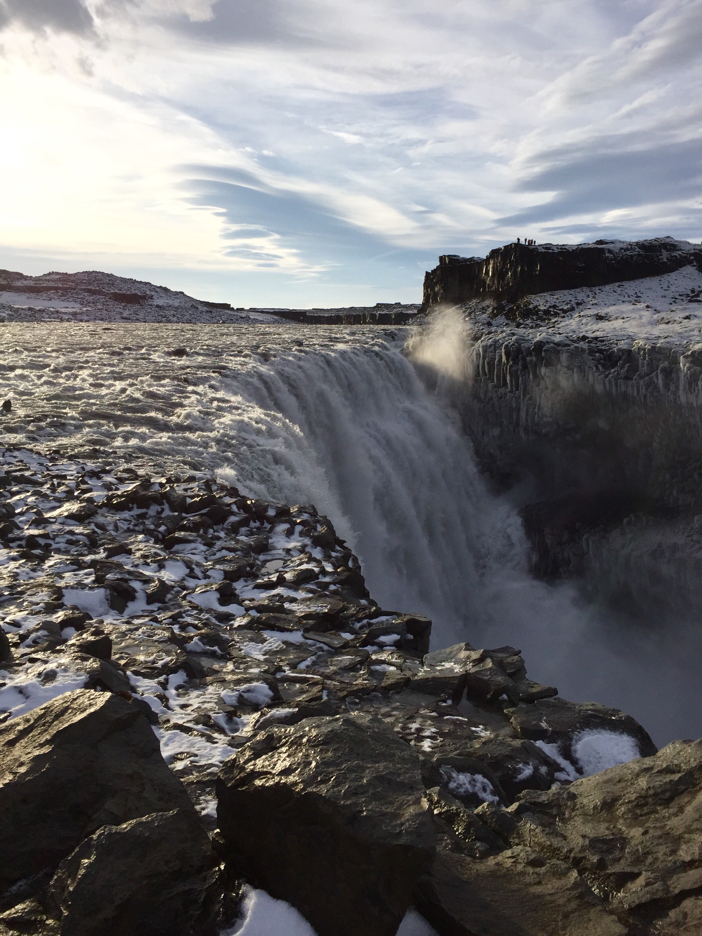
I continued up route 862 but the snow got much deeper so I decided not to tempt fate. I hadn’t seen another vehicle for hours and that was the last place I wanted to be stranded!
I turned the car around and headed to Myvatn. The next stop was Hverir, an active thermal plane. The turquoise ground was eerie and the mud will be stuck to my boots forever. The sulphur smell is pungent and, like the mud, going to be with me for a while. 
I arrived at my farm stay and am now busy downloading my photos. I’m here for two days and tomorrow wil be hiking and more hiking around the lake and around an inactive volcano!
Random images from Iceland
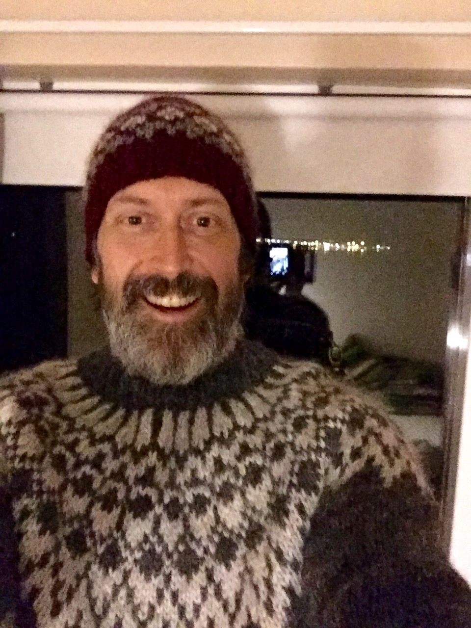
Here are some random iPhone images from my trip. Including an actual image of a person: me sporting my new Icelandic wool hat!